

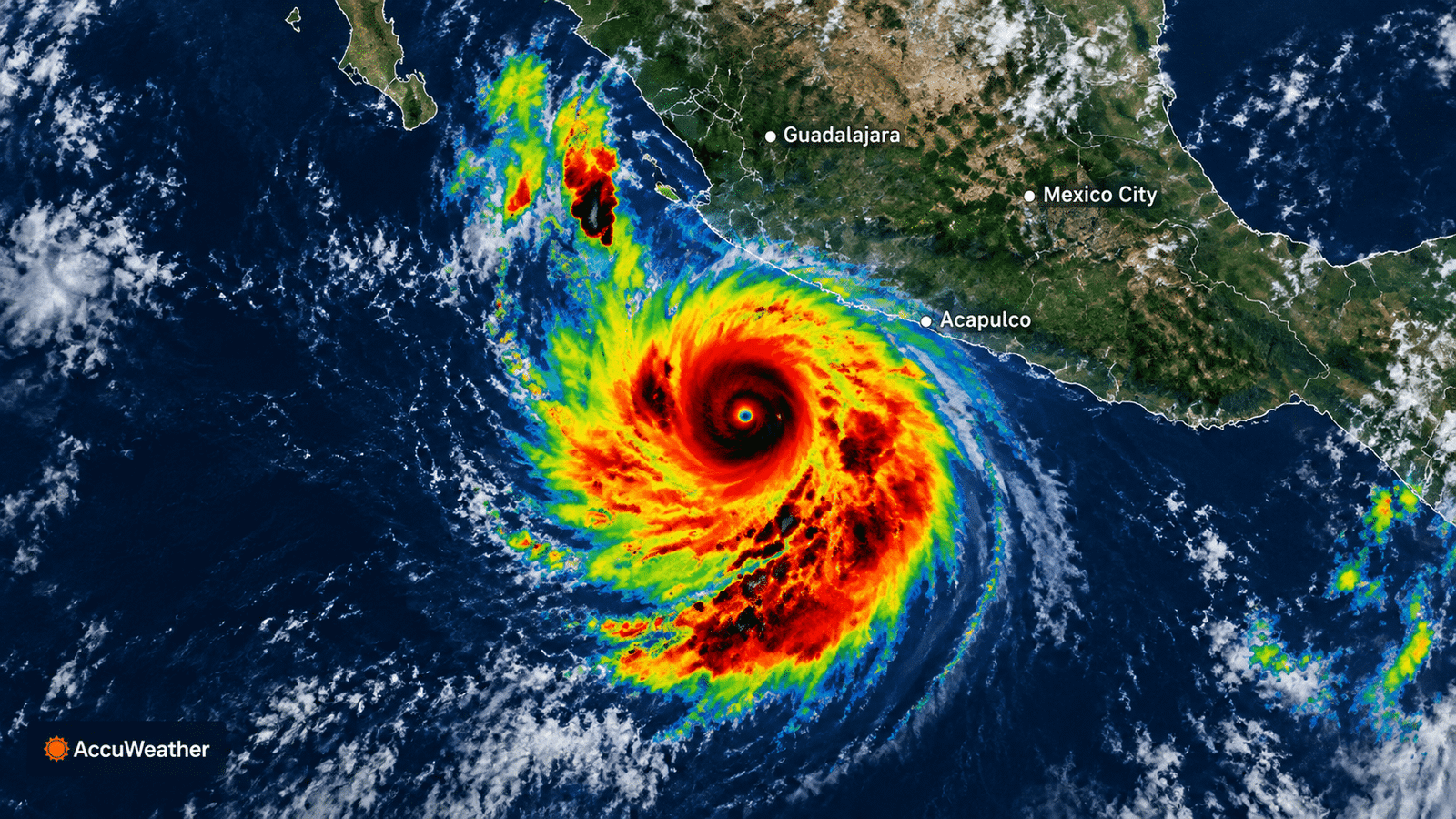
Hurricane Polo 2026: Inside the Record-Breaking Category 5 Monster
Hurricane Polo has rapidly become one of the most alarming storms of the 2026 hurricane season. Just one day after forming as a tropical storm off Mexico’s Pacific coast, Polo explosively strengthened into a Category 5 hurricane. As a result, meteorologists and coastal residents are closely watching one of the fastest rates of intensification ever recorded.
This article breaks down everything happening with Hurricane Polo, including its record-setting growth, current path, and what coastal communities should expect.
Why Hurricane Polo Matters
This storm matters because of the sheer speed and scale of its intensification. Additionally, it marks a rare and historically significant event for the Pacific hurricane season.
- Polo is the third Category 5 hurricane of the 2026 Pacific season, tying a record.
- Its winds jumped by 110 mph in just 24 hours.
- That growth came within 10 mph of the world record for rapid intensification.
Because of these extreme numbers, Hurricane Polo has quickly become the most intense hurricane in the Western Hemisphere so far this year.
Key Facts Behind Hurricane Polo’s Rapid Growth
Explosive Intensification
Hurricane Polo formed on September 20, 2026, as a modest tropical storm roughly 200 miles off Mexico’s Pacific coast. However, by the morning of September 22, it had already reached Category 5 strength with winds near 165 mph.
Meteorologists define rapid intensification as a wind speed increase of at least 35 mph within 24 hours. Therefore, Polo’s actual increase of 110 mph makes it one of the most dramatic intensification events on record.
The Conditions That Fueled Polo
Warm ocean water, low wind shear, and humid air all combined to create ideal conditions for Hurricane Polo to strengthen so quickly. Additionally, an intensifying El Niño pattern has contributed to unusually warm Pacific waters this season, giving the storm extra fuel.
Types of Impacts Hurricane Polo Could Bring
Coastal Wind and Surf Impacts
Although Polo’s core is expected to remain offshore, coastal areas of Guerrero, Mexico may still experience tropical-storm-force winds and dangerous surf. As a result, local authorities have urged residents to stay alert.
Shipping and Port Disruptions
Port authorities near Guerrero have already suspended maritime navigation due to Hurricane Polo. Consequently, fishing operations and coastal shipping routes in the region remain paused until conditions improve.
Historical Comparisons
For many residents along Mexico’s Pacific coast, Polo has revived painful memories of Hurricane Otis, the devastating 2023 storm that struck Acapulco. However, unlike Otis, current forecasts show Polo’s core staying offshore rather than making a direct landfall.
Hurricane Polo’s Current Path and Forecast
Latest Position
As of the most recent advisory, Hurricane Polo was located near latitude 14.6°N, longitude 101.4°W, drifting slowly eastward. Maximum sustained winds remain near 175 mph, officially classifying it as a Category 5 storm.
What Comes Next
Forecasters expect Polo to begin a slow northwestward turn, followed by a more general west-northwestward motion over the coming days. Additionally, while some intensity fluctuations are likely, Polo is expected to remain a powerful major hurricane through the middle of the week.
How Coastal Residents Should Prepare
Immediate Safety Steps
Local officials have already opened temporary shelters in areas like Zihuatanejo as a precaution against Hurricane Polo. Residents in coastal zones should:
- Monitor official National Hurricane Center advisories regularly.
- Avoid coastal areas prone to dangerous surf and rip currents.
- Follow evacuation guidance from local emergency authorities.
Common Mistakes People Make During Major Hurricanes
Many people misjudge storm risk simply because a hurricane’s core remains offshore. However, avoiding these mistakes leads to better preparation.
- Assuming offshore storms pose no danger: Dangerous surf and wind can still reach the coast.
- Ignoring official evacuation notices: Local authorities base these decisions on the latest storm data.
- Relying on outdated forecasts: Storm paths can shift quickly, as Polo has already demonstrated.
What to Watch Going Forward
Moving forward, all eyes remain on whether Hurricane Polo maintains its current strength or continues fluctuating as it tracks along the Mexican coastline. Additionally, forecasters will continue monitoring how the broader El Niño pattern influences future storm activity this season.
Conclusion
Hurricane Polo stands out as one of the most dramatic weather stories of 2026, driven by an extraordinary rate of intensification and record-setting strength. As this powerful storm continues its path along Mexico’s Pacific coast, staying informed through official forecasts remains the best way to stay safe from Hurricane Polo in the days ahead.